ArcGIS is an integrated collection of GIS software products for mapping and spatial reasoning. Its suite of products includes ArcMap (also known as ArcGIS Desktop) and ArcGIS Pro, ArcPAD, Business Analyst and CityEngine.
The university is focusing more on ArcGIS Pro rather than the legacy "Desktop" editions. Classes in Civil Engineering are transitioning to the newer ArcGIS Pro in curriculum.
The software is free to all OSU students.
Windows Desktop computers and Citrix Xen Desktop.
ArcGIS (Pro and Desktop) is available for use in the computer labs, on engineering windows desktops and is also available for students' personal computers.
First-time users should create their online ESRI accounts at osugisci.maps.oregonstate.edu using the enterprise login (ONID credentials). This will ensure you have access to proper software licensing.
In addition to computer labs and Citrix Xen Desktop, students and faculty with ENGINEERING Windows desktop computers can install ArcGIS Desktop and Pro via "Software Center", found in the start menu.
Software for personally-owned laptops and computers can be downloaded from the campus software server.
For more information visit https://softwarelist.oregonstate.edu/software/arcgis
ArcGIS Pro is licensed only by logging into the product after installation. It requires an OSU ESRI online account.
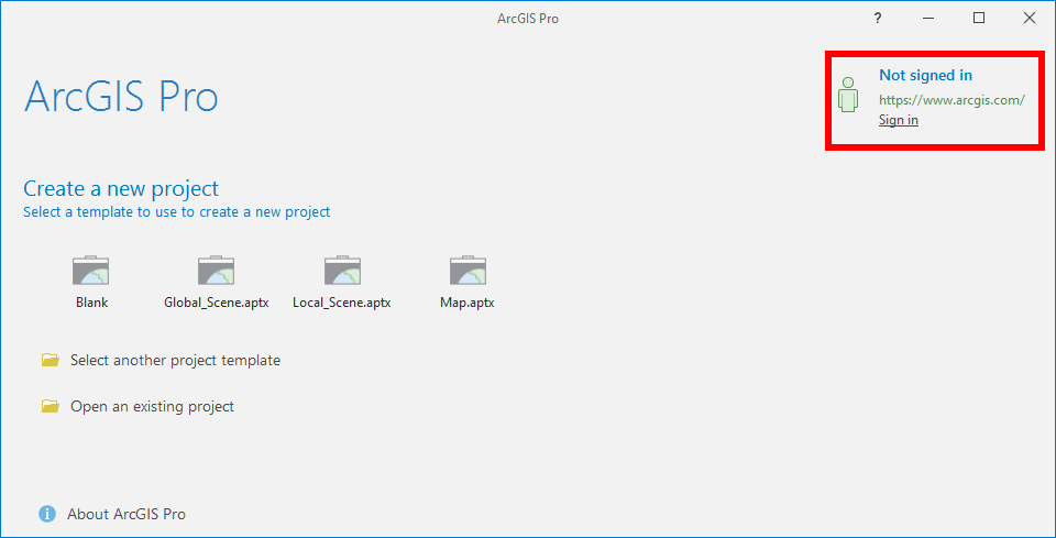
Launch ArcGIS Pro
Click Sign In in the top right corner

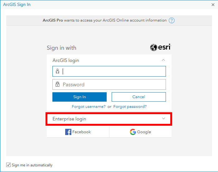
Select the Enterprise login option

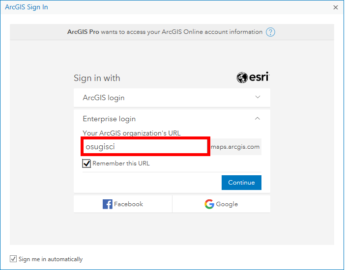
Type 'osugisci' into the text box for Your ArcGIS organization's URL

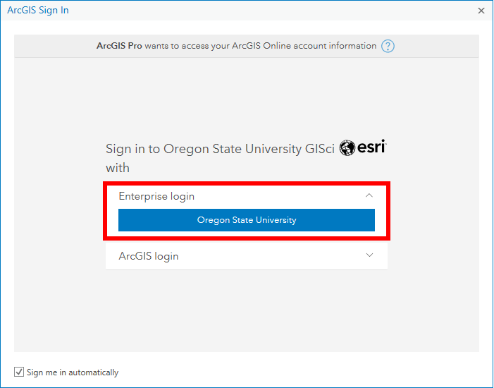
Select Enterprise Login Oregon State University

Authenticate with your ONID username and ONID password
ArcGIS has several online resources to help with using the software here: http://doc.arcgis.com/en/arcgis-online/.
There are help blogs and forums, training courses, tutorial videos and technical support.